A re-assessment of the work of B.L.C. Johnson
| Home | Research
Home |
![]()
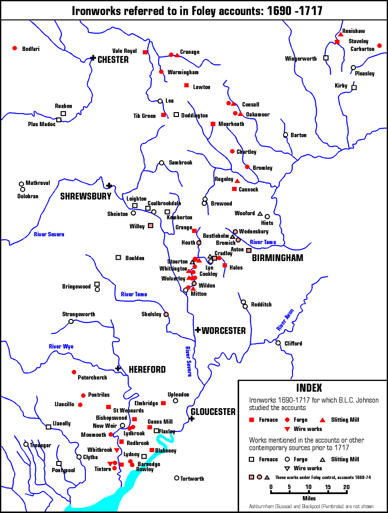
An updated map (redrawn in colour), based on a map by B.L.C. Johnson, shows the Foley's dominance of the Iron trade at the beginning of the 18th century. However at the time this map was made documents and accounts for Philip Foley's earlier "Stour Valley Iron Works" had yet to be made available to scholars or the public. Johnson shows other Ironworks with no reference to their previous control by the Foley's. Subsequent authors have since identified many other contemporary sites in the region, and some of these have been added.
This map shows the intensity of Ironworks on the River Stour, during the later part of the 17th & early part of the 18th Century, and helps to give credence to Nash's statement that "During the reign of Charles the 1st the river Stour became one of the hardest-worked rivers in the kingdom, providing power for blast furnaces, tilt hammers, and slitting mills located along its length". (History of Worcestershire 1799)